Map Legend Definitions
Final Pass
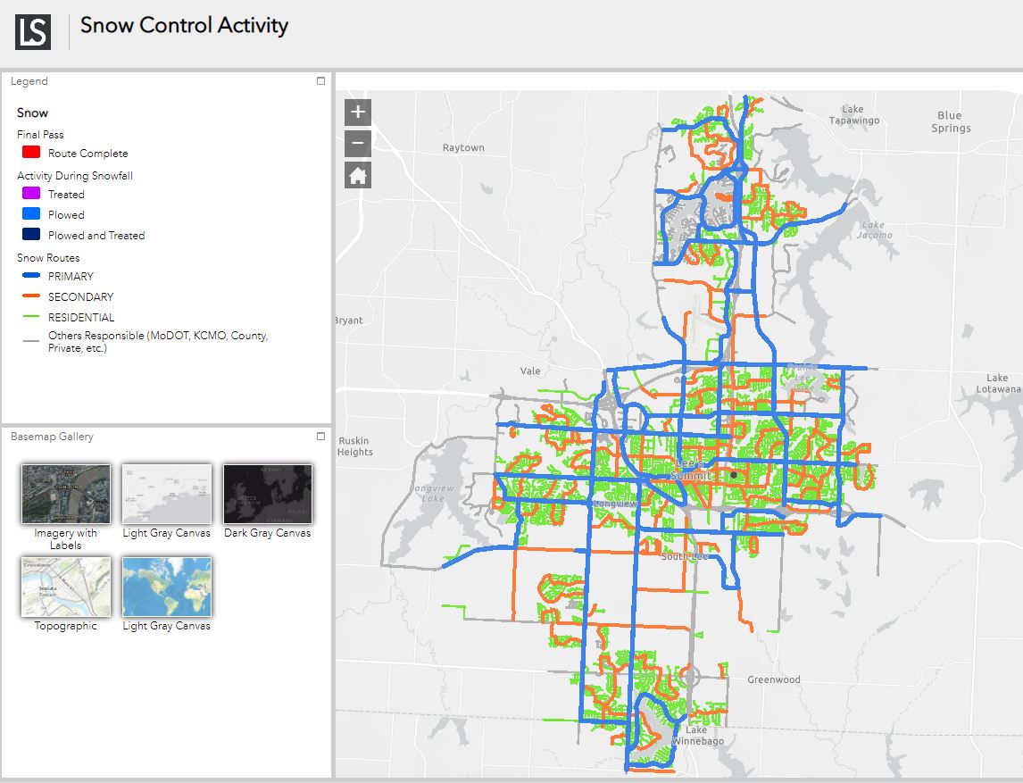 The map is pre-set with the snow event response level and goal time, and the map shows when the final pass is complete.* For example, the response and goal time may be to treat all streets with salt within 24 hours. When the activity on that route is completed, it will be updated on the map as complete. More detailed information about the response level and goal time are provided under Snow Updates.
*Please note that due to changing weather conditions, response levels and goal times can change throughout an event. For example, due to improving weather conditions, salt treatment may no longer be necessary. In this case, some routes will show as complete and others will not. As another example, crews may have to return to plow primary routes if it starts snowing again. In this case, routes will show as completed but are not due to the new snowfall. Information is updated on the map when response levels and goal times are changed, but there may be a lag.
Activity During Snowfall
An activity is how crews are responding to the current snow fight, which may include plowing, treating, or both plowing and treating. The activity taking place is typically dependent on the total snow/ice accumulation. Detailed information about what activities are taking place can be found under Snow Updates.
Snow Routes
A route is a City-designated classification given to a street such as primary, secondary or residential.
- Primary: major multi-lane or high volume two-lane streets
- Secondary: minor thoroughfares and residential collectors
- Residential: local streets, including dead-end streets and cul-de-sacs
Primary and secondary streets are the main priority when snowfall begins. Residential streets are plowed last. Residential streets are broken into routes and are rotated so no street is always first or last.
Routes in gray marked "other" are plowed and/or treated by another entity, not the City of Lee's Summit. For example, MoDOT plows and/or treats I-470, US-50, M-291 and M-150 along with the respective interchanges and most frontage roads.
Information about which routes crews are working in is provided under Snow Updates. Depending on the snow event and the number of drivers, crews may be able to move to additional routes more quickly.