Access and Equity
Although Lee’s Summit is a suburb that owes much of its prosperity and growth to automobile use, today, not all households own a vehicle. According to Census data for Lee’s Summit, 4% of households (1,377) do not own a car, and due to a lack of other transportation options, their mobility is limited. However, 8% of Lee’s Summit households (2,754) are families with children living below the poverty level, suggesting they are cost-burdened from owning a vehicle. The average household in Lee’s Summit spends $13,334 per year on transportation costs - 16% of the City’s median household income ($85,183).
While approximately 5.2% of Lee’s Summit residents live below the poverty line, reducing the annual cost of transportation would increase the amount of household income available for other needs.
Nearly 10,000 people over the driving age face mobility challenges (including hearing, vision or cognitive disabilities) that prevent them from using a car. Driving a privately-owned vehicle is not an option for these residents, and their dependents under the legal driving age must rely on walking or bicycling to get around due to the lack of a robust public transportation system.
Workforce
The Kansas City region’s efficient and far-reaching highway system provides short commutes to Lee’s Summit for many workers coming from outside the City. Before the COVID-19 pandemic, employers had difficulty filling job positions, potentially due to Lee’s Summit’s relatively higher cost of living and the lack of public transportation - factors that tend to limit economic growth.
Lee’s Summit residents rely primarily on automobiles for transportation, with the Census data counting 83 percent who commuted by driving during 2014 2018 (U.S. average was 76% during the same period). During this time frame, the City also saw an increase in car ownership of one- (15%), three- (21%) and four-vehicle (142%) households, with a minor decrease in two-car households (7 percent). Those people most reliant on cars are commuters - 61% of workers travel outside the City for work, with half of these journeys in the range of 10-24 miles. Only 6.5% took advantage of carpooling between 2014–2018.
Where Residents Are Leaving to Work
| |
# of Workforce
|
% of Workforce
|
|
Kansas City, Mo
|
13,609
|
28.3%
|
|
Lee's Summit, Mo
|
9,987
|
20.8%
|
|
Overland Park, Ks
|
3,756
|
7.8%
|
|
Independence, Mo
|
2,873
|
6.0%
|
|
Blue Springs
|
1,596
|
3.3%
|
|
Kansas City, Ks
|
1,367
|
2.8%
|
|
Lenexa, Ks
|
1,354
|
2.8%
|
|
Olathe, Ks
|
873
|
1.8%
|
|
North Kansas City, Mo
|
803
|
1.7%
|
|
Grandview, Mo
|
758
|
1.6%
|
|
All Other Locations
|
11,085
|
23.5%
|
|
Total All Workforce
|
48,060
|
100%
|
Less than 1% either walk or take public transportation. Within city limits, there are 34 highway miles, including highways I-470, US-50, MO-350, MO-150 and MO-291. The City owns and maintains 1,068 lane miles of roadway.
Prior to the COVID-19 pandemic, 7.2% of Lee’s Summit residents worked from home, and that number is expected to grow post-pandemic, depending on the sector. More people leave Lee’s Summit to work than commute into the City for work.
Most Lee’s Summit residents who leave to work elsewhere drive alone to jobs in Jackson County and Johnson County, Kansas. More than half commute 10–24 miles.
Transit stops located along US 50 Highway south of I-470 serve the densely populated areas of Lee’s Summit. Stops along Lee’s Summit Road, the City’s northwest border, serve lower-density areas. Access to transit south of US 50 Highway is limited, and most transit users in this area of town do not walk to Lee’s Summit Express stops, they tend to park and ride. These fixed-route transit services have limited operations and limited connections for peak weekday commuter traffic hours only.
The Lee’s Summit Express primarily takes riders to and from Kansas City, Missouri, without service to Kansas, where more than 15% of Lee’s Summit residents work. Transit also does not serve Independence, where many workers come to work in Lee’s Summit.
Public transit service is limited in Lee’s Summit and to the rest of the region, with only two small bus routes (Route 340–TMC Lakewood and Route 550–Lee’s Summit Express served by RideKC). The express services have experienced a decline in ridership. Capacity continues to meet demand.
People requiring in-city, door-to-door service can use the on-demand RideKC Lee’s Summit service operated by OATS. This demand response transit serves approximately 25,300 trips annually. Demand has been increasing. Service denials have also been increasing, but they are still relatively few.
According to a Transit Service Assessment conducted for the City in 2015, the current annual ridership potential for transit in Lee’s Summit is around 171,000. Population growth forecasts for 2040 show that ridership potential could grow to 221,000 (only considering one-way trips), a 29% increase.
A 2015 Transit Service Assessment study identified challenges to providing adequate transit, including the low population of residents living within walkable distance to existing fixed bus routes. In addition, there are few connections to key urban areas and some routes require multiple transfers and inconvenient travel to reach destinations for the 30,000 commuters who frequently require transportation beyond Lee’s Summit boundaries.
Roadways
Efficient road planning in Lee’s Summit (and any city) influences how people choose to get around, including potential access to a variety of transportation modes. The Thoroughfare Master Plan shows which City’s primary streets and roads are expected to reach vehicle capacity by 2025 and 2040, pointing to a need for near-term and long-term strategies that accommodate travel demand and encourage a partial shift from people driving alone in cars for daily trips.
Rail
Amtrak passenger rail to or from Lee’s Summit offers potential increased regional connectivity and reduces single-person vehicle trips. However, the Missouri River Runner and Southwest Chief routes only make a few stops in the City per day, and only serve a limited number of travelers with specific destinations near its stops.
Municipal Airport Master Plan
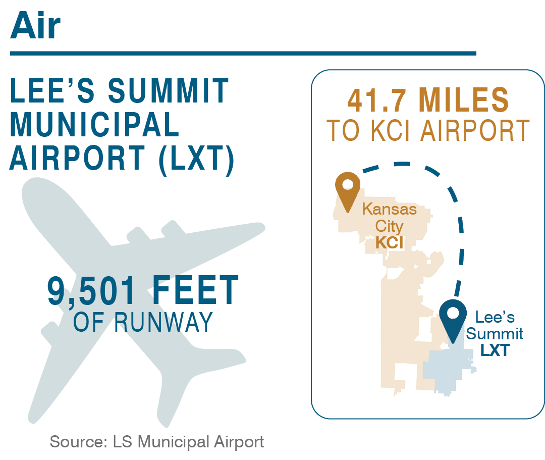 Most of the airport’s current Master Plan and Business Plan recommendations are complete. Implementation of these plans strengthened the airport’s position as a premier Fixed Base Operator (FBO) in the Kansas City area and the U.S. The City of Lee’s Summit is currently developing a new 20-year Master Plan and Business Plan for the airport to ensure the airport’s continued success. The recent increase in aircraft operations and airport-owned land providing potentially more airfield access are driving the planning process.
Bicycles
Lee’s Summit became the first city in Missouri designated a Bicycle-Friendly Community in 2012, thanks to the Bicycle Transportation Plan’s adoption in the City’s Comprehensive Plan. The Bicycle Plan outlines a long-term strategy for providing improved bike routes and networks that will improve options for short trips. In contrast, but with overlapping accommodations, the Greenway Master Plan highlights the recreational biking and walking opportunities and the existing trail network.
All City-owned roadways permit bicycles, but not all are bike-friendly. The Bicycle Transportation Plan outlines a comprehensive approach to the overall bike network. The plan features more than 100 miles of connector routes throughout the City, including on-road, unprotected facilities (such as shared streets and bicycle lanes) and protected trails.
The Bicycle Transportation Plan emphasizes that “bicyclists need an interconnected system of greenway trails, shared-use paths and roadways to reach all desired destinations.” It also clarifies that “different types of bicycle facilities are appropriate in different situations.” This follows national best practices that emphasize flexibility in bicycle facility design, based on place-specific constraints.
Strategic infrastructure improvements throughout the City would encourage and safely accommodate more riders of all skill levels. One of the goals in the Greenway Master Plan is “to continue to incorporate on-street bicycle improvements and multi-use trails along streets as a routine part of scheduled roadway construction and retrofit projects.”
The Bicycle Transportation Plan identifies strategies for improving bike network design, route integration, and signage, including capital improvement projects, maintenance projects, and modification through development/ redevelopment projects. These strategies will require creative coordination and funding through potential sources like the Congestion Mitigation & Air Quality Program, Surface Transportation and Bridge Program, and Transportation Enhancements Program administered by the Mid-America Regional Council.
Pedestrians
The City Health Dashboard measures health and other drivers for the 750 largest U.S. cities with a population of more than 50,000. Overall, Lee’s Summit is healthier than the average of these municipalities. But in terms of walkability, Lee’s Summit scores lower than other cities. This is based on a specific measure of walkability that features a greater mix of land uses short distances apart. A different measure might help communities like Lee’s Summit, where people living in neighborhoods that are connected with their street and sidewalk networks might be able to walk, but may have limits on what they can walk to. Or, alternatively, Lee’s Summit might also adopt growth policies that promote this mix of use within short distances. The City Health Dashboard suggests that communities achieving this more balanced, destination-focused definition of walkability tend to have more active residents, including how often they walk and use public transportation. Research finds that people in such neighborhoods have lower rates of diabetes and obesity than those living in less walkable areas. Walkable neighborhoods often have less vehicle use, which also leads to better air quality.
The City’s network of sidewalks is comprehensive, thanks in part to voter support in approving $2.5 million for closing existing gaps and constructing new sidewalks. The City also influenced the design of interchange projects to increase connectivity across interstate freeways and links to two trail systems. Lee’s Summit was also the first city in Missouri to earn a Silver-level Walk-Friendly Community designation, thanks to a comprehensive series of community-supported efforts and the adoption of its Livable Streets Policy.
Like all municipalities, Lee’s Summit maintains an Americans with Disabilities Act (ADA) Transition Plan to ensure compliance with that law’s accessibility requirements. The ADA Transition Plan is an important, ongoing tool for ensuring that sidewalks accommodate users of all abilities and are present on both sides of the street.
As the City continues to grow, demand could reach a point where more balanced travel modes could be necessary to ensure mobility for the community. The Thoroughfare Master Plan does not project land use; it reflects the land use illustrated in the Comprehensive Plan. The land uses are applied for trip generation purposed only to assess transportation forecasts, level of service and needs. The Thoroughfare Master Plan will be updated following the adoption of the Comprehensive Plan to reflect changes in land use including the activity centers and other intense land uses. These developments could attract many more residents, workers and visitors, thus increasing traffic congestion while significantly impacting mobility and the character and livability of the City’s older neighborhoods. A shift to alternative modes of travel could mitigate these outcomes, even in areas not designated as Activity Centers or connecting corridors in the Ignite! Comprehensive Plan.